Sailing to Stornoway

Leaving Ullapool behind us, we began the 2.5 hour sailing over to the Western Isles, AKA the Outer Hebrides, to the Isle of Lewis & Harris, home to the largest town, Stornoway…

We were sat aboard the MV Loch Seaforth, which had just departed from the small port of Ullapool. It set out into Loch Broom, from where it would join the Minch, the strait of water between the mainland and Lewis & Harris.

It was still early morning, the sun was shining high in the sky and some of the most spectacular views of our holiday in the Highlands would soon be revealing themselves.

We did have one extra passenger on our trip, a new friend we picked up the day before in Fort William. Looks like we know where the Loch Ness Monster goes on holiday!

A few miles North up Loch Broom, we passed “Rhue Lighthouse”, located where the Loch begins to give way to the Minch.

The Lighthouse was built in 1902, and stands around eleven metres high. The original lens from the Tower can now be found in the Ferry Terminal back in Ullapool, after it was replaced by a new solar powered light in 2002.

The Ferry itself was fantastic. There was lots of space, and a nice choice of places to sit, inside and out. There was free and easy access to the outside decks at all times during the voyage, which quickly became our favourite place to enjoy the journey…

Heading out into the Minch, we got just the most spectacular view back at the mainland. The peaks and troughs of the Scottish Highlands were laid out before us, and in the distance we could also possibly discern the outline of the Isle of Skye.

We had the perfect weather to make this trip, as in wet or hazy conditions the mountains would have been completely obscured.

You can stand at either end of the outside deck, and as we advanced through the crossing, we swapped to the Northward facing section of the ship. Eventually, the outline of the Western Isles themselves loomed over the horizon.

The Isles are made up of a number of islands, fifteen of which have permanent populations. The largest is Lewis & Harris, also home to the islands capital, Stornoway. The island is also the third largest of the British Isles, after Great Britain, and Ireland.

As we neared our final destination, we sailed passed the “Arnish Point Lighthouse”, designed by Alan Stevenson (1807 – 1865, Lighthouse Engineer from Edinburgh) in 1852.

Built for the Northern Lighthouse Board, which covers Scotland and the Isle of Man, it was the Boards first ever pre-fabricated Lighthouse, thanks to its new design of iron with a timber lining.

It guards the entrance to the Harbour around Stornoway, which has various rocks, beaches and outcrops which need to be navigated by incoming ships.

We soon arrived in Stornoway itself, a stunning little town which we couldn’t wait to explore…

Rendezvous with a Ferry in Ullapool

The next morning we made our way to Ullapool, to pick up the ferry out to Stornoway…

Ullapool:

Status: Highland Unitary Authority,  Town, Scotland

Date: 15/03/2016

Travel: Car, Ferry (Ullapool – Stornoway)

Eating & Sleeping: N/A

Attractions: Sir John Fowler Memorial Clock Tower, Loch Broom, Loch Droma, Harbour, Ferry Terminal, Caledonian Hotel etc

The route to Ullapool along the A835 provides plenty of opportunities for you stop and admire the scenery. If you haven’t been this way before and you have a ferry to catch, I would recommend that you leave a little earlier to allow for the scenery!

Our first stop was on the shores of Loch Droma, a small Loch with a commanding view out across the surrounding mountains.

We had had an early start, so the morning mist was still hanging low across the surface.

The Loch is drained by the River Droma at the Western End…

… which then empties out into Loch Broom, about ten miles away. This vast body of water stretches all the way to Ullapool itself, with a total length of around ten miles.

We kept following the Loch, stopping occasionally to admire the ever present mountains on the horizon.

Eventually, the town of Ullapool loomed in the distance, a charming little place in an idyllic setting.

We had a bit of time before our ferry left, so we parked up in the large free carpark in the town centre, and set out to explore.

On Argyll Street, we came across the “Sir John Fowler Memorial Clock”, erected in 1922. It pays tribute to Sir John Fowler, 1st Baronet (1817 – 1898, English Civil Engineer from Sheffield). He was a prominent designer, responsible for the Metropolitan Railway in London which was a precursor to the London Underground, as well as the Forth Railway Bridge.

The Clock also remembers Sir John’s son, Captain Sir John Edward Fowler, killed in action during World War I in 1915.

The Clock sits adjacent to the “Caledonian Hotel”, shown left. It has the distinction of being the oldest hotel in Ullapool. Large settlements are few and far between on this side of the Highlands, making Ullapool the perfect base to explore the surrounding area.

The waters of Loch Broom lap against the shore here, and much of the design work for the harbour was the work of Thomas Telford in 1788. Ullapool has historically been a fishing town, originally starting with Herring.

Various mountains can be seen from Ullapool, and on a sunny day you can see for miles in each direction. The Highlands are a magical place, and so far we weren’t disappointed.

Starting in the 1970’s, the Harbour became home to a regular fleet of “Klondykers”, Mackerel Processing Ships from countries in the Eastern Bloc such as Russia, East Germany and Poland. It was a major boom of the economy, which sadly disappeared in the 1990’s with the collapse of the USSR.

The main Harbour was extended by 33 metres in 2014 to accommodate a brand new Ferry to run the service to Stornoway, the MV Loch Seaforth.

There are daily sailings out to Stornoway from the Ferry Terminal, which can take both foot passengers, and vehicles. Journey times average around 2 hours 30 minutes.

Inside the Ferry Terminal is the “Rhue Light”, the original Lense from the Rhue Lighthouse. The Light was established in 1952, and stands at the edge of Loch Broom where it becomes the Minch, the area of sea between the mainland and Lewis & Harris where Stornoway is located.

The light was always unmanned, and a clock in the building turned the light on and off at the appropriate time. A new light was installed in 2002, and works off Solar Power.

Half an hour later, the aforementioned MV Loch Seaforth arrived, and we boarded, ready for our journey out to Stornoway…

Inverness, Highland, Scotland

Our final destination of the day was the city of Inverness, our 7th and final city in Scotland…

Inverness:

Status: Highland Unitary Authority, City, Scotland

Date: 14/03/2016

Travel: Car

Eating & Sleeping: Travelodge (A96)

Attractions: Inverness Castle, River Ness, Inverness Cathedral, Town House, Falcon Square, Steeple Tower, Old Court House, Greig St Bridge, Ness Bridge, Free North Church, Old High Kirk, St Columba’s, Eastgate Shopping Centre, Eastgate Street, Victorian Market, Old Caledonian Bank etc

We parked up in the Multi-Storey Car Park in the Eastgate Shopping Centre, which opened in 1983, and was later extended in 2003. It is an important shopping destination for the Highlands, as is Inverness as a whole, serving the largest catchment area in Europe. The Highlands is a vast area, and there are only two sizeable settlements, Inverness and Fort William.

Out in Falcon Square in front of the Centre stands the Mercat Cross (Scots for Market Cross). The cities original cross was erected in 1685, whilst the one we saw before us was a brand new design by Gerald Laing in 2003. The National Animal of Scotland, the Unicorn, adorns the top of the 37 ft cross, along with four falcons encircling it. The Falcons are in memory of John Falconer who opened the Falcon Foundry in 1858, although most of it has long since been demolished.

A few blocks East along Academy Street from the Square is Inverness Railway Station, which opened in 1855, originally the Terminus of the Inverness & Nairn Railway,  roughly 17 miles long.

It eventually joined first the Highland Railway, and then the LMS (London, Midland and Scottish Railway) which ran most mainline services across the UK, after four large train companies merged.

Today the station runs services East to Aberdeen, South towards Glasgow, and North up to Thurso, for ferries to Orkney. A number of services also run up the ECML (East Coast Main Line) direct from London via Edinburgh up to the city.

Outside the station sits a Memorial to the Cameron Highlanders. 141 soldiers were killed whilst fighting in Egypt and Sudan during the 1880’s, so a permanent Memorial was erected in 1893.

We cut through to the River Ness from the Railway Station, and made our way to the steep slope atop which you will find Inverness Castle.

This beautiful looking building was the work of William Burn (1789 – 1870, Scottish Architect from Edinburgh) in 1836. It is the more modern incarnation of Inverness’s defenses, as there have been various Castles here since the 11th Century.

The most notable is a large, towered Castle from 1548, whose occupants famously denied entry to Mary Queen of Scots in 1562, causing the towns folk to take the Castle by force for her.

Not only does the Castle have a commanding presence along the River, it also offers the best view in the City.

In the distance, the prominent peaks of Ben Wyvis and Little Wyvis steal the skyline. They lie on the Northern side of the Beauly Firth, where the River Ness below us is gently heading.

The Ness is but 12 miles long, and connects Loch Ness with the Firth. The final stretch of the Caledonian Canal runs parallel for much of the route, again heading for Beauly.

Inverness has a number of well known Churches, whose spires are dotted around the skyline.

There is one religious building in particular though that stands out when your stood looking out from the Castle.

It is of course the Cathedral of St Andrew, on the far side of the River. It belongs to the Scottish Episcopal Church, and was founded in the 1860’s. A large Diocese covering the former counties of Moray, Ross and Caithness had just been created, and as the largest settlement in the area, Inverness was chosen to host the new Cathedral.

The twin towers at the Northern end of the building were originally intended to hold large spires, but sadly a lack of funds meant they were removed from the design.

Leaving the Castle Mound in all it’s glory, we took a walk down the River, to take in some city views.

A number of bridges cross the River Ness in the city centre, and we stopped at the “Greig St Bridge”, a Steel Suspension Bridge from 1881, although it looks far newer!

You get a fantastic view from here, with the Castle in the distance, and many of the cities Churches lining the riverside.

On the left is St Columba’s, built by Mackenzie & Matthews in 1852.

In the distance, crossing the river further upstream is the Concrete Ness Bridge from 1959, the latest in a long line of structures to cross the River in that spot.  Until 1685 a Wooden Bridge was used, before making way for a new Stone one, destroyed in a Flood in 1849.

Here on the bridge, we were also level with another two Churches, starting with the “Free North Church” on the right.

Another Victorian Era addition, it was created by Ross & Macbeth in 1892, for the Presbyterian community. This particular branch of Presbyterianism has over 100 congregations in Scotland alone, as it has aligned with the Church of Scotland.

To the left is the “Old High Kirk”, the oldest Church we have come across so far. The main tower dates back to an earlier Church from the 16th Century, whilst the rest of the building was rebuilt between 1769 – 1772. The Tower features an unusual octagonal spire, which also predates rebuilding.

Moving back to the City Centre, we stopped outside one of the cities hidden Gems.

Taking up a whole block, is the stunning Victorian Market, built to replace the outdoor Market Place in the late 1870’s. The original building was destroyed by a fire not long after, so the present Market is from 1891.

Inside are hundreds of shops, in a maze of canopied districts. If you head round to Academy Street, almost directly opposite the entrance to the train station, you will find the original sandstone entrance to the pre-fire building.

From here we cut through to “Eastgate”, the main thoroughfare in the city. It contains many of Inverness’s local landmarks, including the Inverness Steeple Tower, visible further down the street.

The Steeple is Georgian, completed in 1791. The spire contains three large bells, 150 ft above the streets below. To the left of the Steeple is the adjoining “Old Court House”, from 1794.

Two buildings over to the right from the Steeple is a large building with Corinthian Columns above the entrance. This was purpose built in 1847, again by Mackenzie & Mathews, as the new Head Office of the Caledonian Bank, founded in Inverness in 1838. It would eventually merge with the Bank of Scotland in 1907 after near bankruptcy.

Eastgate is full of ornate buildings, with another good example being “Numbers 21 – 23a High Street”, the large building with turrets at either end of the roof.

Designed by Matthews & Lawrie, it was topped out in 1879 and is currently split up into a number of tenants, although the majority is currently used by the Highland Hostel.

On the far side of the street is one of the buildings I was most looking forwards to seeing… only to find it obscured by scaffolding!

Inverness Town House is one of the cities most stunning constructions, another lasting Victorian legacy, from 1882. It would first house the Town Council for what was then the Royal Burgh of Inverness, and now local offices for Highland Council.

The Town House, and Inverness itself also has a peculiar distinction with regards to government functions. The British Cabinet regularly meets at 10 Downing Street in London, however this changed for one day in 1921. Many of the Cabinet Ministers happened to be in Northern Scotland, when the Prime Minister, David Lloyd George had to call an emergency meeting in response to the worsening situation in Ireland. It was held at the Town House, the first time it had ever been held outside of London. The meeting resulted in the Anglo-Irish Treaty, allowing Southern Ireland to secede from the UK, whilst allowing the North to remain if requested.

Inverness is a magnificent city, and I am sure we only saw but of a fraction of the historic buildings on offer here. Against the stunning backdrop of the Highlands, it is a special place indeed.

It benefits from good transport links, as I said earlier, such as rail links to Thurso, Aberdeen and Glasgow. The A9, the main North/South route from the Central Belt to the Highlands bypasses the city to the North, whilst you can also take the A82 West to Fort William/Loch Ness, or the A96 East to Elgin and Aberdeen.

Inverness is also a good base for day trips out into the Highlands, and the cities Airport provides links to Shetland and Orkney.

The next morning, we left our hotel on the outskirts of Inverness, and headed North West along the A835 towards Ullapool, for our ferry to Stornoway…

Great Glen Road to Inverness

Leaving Fort William, we still had 65 miles to go to reach our base for the night, Inverness. Our next stop was the famous Commando Memorial, 10 miles away in Spean Bridge…

This incredible 17 ft tall monument was created by Scott Sutherland in 1951, and features three Soldiers, looking out across what was once the Commando Training Depot.

During World War II, under orders from Winston Churchill himself, a large task-force of Commando’s were trained here in readiness for the Invasion of Europe. Over 1,500 Commando’s were killed in the eventual battles, and the Monument pays tribute to their sacrifice.

The Soldiers have a unique setting, as they not only gaze out across their old training grounds, but also Scotland/Britain’s highest peak, the edifice that is Ben Nevis, shown centre.

With a total height of 4,411 ft, it marks the highest point in the United Kingdom, atop what was once an active volcano. The first ascent on record was by James Robertson (Botanist from Edinburgh) in 1771. Ben Nevis is easily accessible from Fort William, which became a popular starting point after the arrival of the West Highland Line in 1894.

Our next stop was Loch Lochy, one of the Lochs which makes up the Great Glen Fault.

There is a small pull in next to the Loch, which was almost perfectly still, reflecting the bright blue sky above it. Sometimes you forgot your still in Britain, it feels like you could be in the Canadian Mountains, or the American Rockies.

Loch Lochy is Scotland’s third deepest Loch, although it doesn’t look it from this vantage point. It is joined by the Caledonian Canal to both Loch Eil to the South, and Loch Oich to the North.

If you follow the Caledonian Canal North, you will first pass through Loch Oich, and then through another section of the Canal to the famous lock gates at Fort Augustus. As the next section is Loch Ness, the famous figure of Nessie can be found next to the Canal, in tribute to the legendary monster who supposedly resides in the Loch.

Fort Augustus is one of three major forts which form a rough line across the Highlands, from Fort George near Inverness, down to Fort William. This eventually gave the town its name, after the garrison created by General Wade in the 17th Century.

The area has seen many battles, particularly during the Jacobite Rebellions in the 18th century.

Construction on the Caledonian Canal began in 1803, with working being carried out at both ends, to eventually meet somewhere in the middle. A total of 60 miles was built, utilising the Lochs in between, connected by specially dug Canals.

It reached Fort Augustus in 1816, with the set of five locks complete by 1820, under the supervision of Simpson & Cargill.

Looking past Nessie, the entrance to Loch Ness is just visible, and the next leg of our journey along the A82 would let us get much closer!

Around two thirds of the way along Loch Ness, are the picturesque ruins of Urquhart Castle. The Great Glen has long been a strategic line through the Highlands, hence the three Forts I mentioned earlier.

Urquhart Castle is located on an outcrop into Loch Ness, with good visibility across the Loch. Although it is highly likely it predates this, the earliest record of the Castle is from 1296, after Edward I and the English Army invaded Scotland, and captured the Castle.

It kept changing hands between English and Scots for the next couple of centuries, before passing into the hands of the Earl of Huntly. Various raids were carried out in the area by local Clans, and in 1527 one such raid left the Castle partially ruined, although it was later repaired. The last major offensive the Castle saw was in 1690, after a 500 strong army of Jacobites attempted to invade. It was defended by soldiers loyal to William of Orange, and the soldiers largely held out until the overall Jacobite rebellion had been put down. They then blew up the Castle to stop the Jacobites taking control. The Castle has slowly decayed ever since, being protected by the Seafield Family from 1884, and it is now owned by Historic Scotland. The public can visit for a fee.

On the left you can see the “Grant Tower”, the most secure sections of the Castle, and one of the most extant. At five storeys it would have been a fantastic look out point and a good place to hole up in if the rest of the Castle was taken.

Loch Ness is quite a site to behold. At 23 miles long, it is the second largest Loch in Scotland, after only Loch Lomond, although by volume it is the largest overall. It stretches as far as the eye can see, bounded on all sides by Mountains and Hills.

It is perhaps most famous for the Loch Ness Monster, of which there have been numerous sightings over the last few centuries. It wasn’t until George Spicer’s account in 1933 that the idea really began to take off, and there have been many attempts to prove its existence ever since, including faked footage. A famous photograph called the “Surgeon’s Photograph” after Robert Wilson, a Gynaecologist from London, was published in 1934, reputing to show the Monster. It has since been denounced as fake, yet the interest remains.

There are plenty of stopping points along the Loch by the main road, although so far no sightings!

We would soon arrive in Inverness, the last stop of the day…

Fort William, Highland, Scotland

After a stunning drive up through the beginnings of the Scottish Highlands, we arrived at the Great Glen, as we pulled into Fort William…

Fort William:

Status: Highland Unitary Authority, Town, Scotland

Date: 14/03/2017

Travel: Car

Eating & Sleeping: N/A

Attractions: Loch Eil, Duncansburgh Parish Church, Donald Cameron Statue, War Memorial, High Street, West Highland Museum, St Andrew’s Church, Gordon Square, West Highland Way, Gordon Square Statue, Caledonian Canal etc

Fort William is a sizeable stop in the Highlands, as it is the second largest settlement in the whole Council Area, after only Inverness. It is a big centre for Tourism, particularly for exploring the surrounding Highlands, and is also located on the West Highland Line, with trains coming from Glasgow in the South, and running North over the famous Glenfinnan Viaduct to Mallaig, for ferries to the Isle of Skye.

The town centre itself is quite historic, and there a number of interesting buildings and monuments to discover. We started at “The Parade”, a large green open space in the centre of town.

In the background stands Duncansburgh Parish Church, completed to designs by David MacKintosh (1848 – 1891, Architect from Oban) in 1881.

There are two major monuments located here, starting with the statue of Donald Cameron, 24th Lochiel (1835 – 1905, Scottish Conservative, MP for Inverness-Shire). Sculpted by W. Birnie Rhind, the Statue was unveiled in 1909, with Donald in his traditional Scottish Attire.

Stood parallel with Donald is the towns War Memorial, originally erected after World War I in memory of the troops from the town and wider area killed in battle.

At the bottom of the Memorial 1939 – 1945 was added a few decades later, to mark the second deadly World War.

The Soldier atop the Monument is presumably from the Queen’s Old Cameron Highlanders, many members of whom are listed on the Memorial, from both World Wars.

Striking quite a pose on the towns skyline, but not part of the Parade itself, being further along on Bank Street, is the Episcopal Church of St Andrew’s.

Built concurrently with Duncansburgh Parish Church, it opened a year earlier, in 1880. The Architect was Alexander Ross (1834 – 1925), this time hailing from the East in Inverness. It is by far the tallest building in Fort William, visible from all over town.

Like many towns in Scotland, Fort William is quite picturesque to explore, with some fine architecture lining the High Street, typical of Scottish buildings from the 18th and 19th Centuries.

It’s also the perfect place to stock up on supplies, be you camping, hiking or just enjoying the area.

For visitors to the town interested in it’s history, you can take a tour of the West Highland Museum, which is located on the Southern side of Gordon Square in the middle of the High Street (out of shot to the right).

The square also marks the end of the “West Highland Way”, a 96 mile footpath from Milngavie, just outside the City of Glasgow, up through the Highlands to Fort William. It is a well known trail, with some incredible scenery. It is estimated the path is used by around 80,000 walkers every year and broken into stages the whole route is doable.

The featured statue represents a tired walker, resting his weary feet after reaching the finish line in Fort William. The original finish line was considered to be quite lacklustre, so Gordon Square was revamped to create a new one, and on the pavement in front of the statue is a Caithness Stone map of the walking route.

Fort William lies on the shores of Loch Eil, a vast Lake which flows into Loch Linnhe South of the town itself.

This makes it jointly the last major body of water to the West on the Great Glen Fault, preceded by Loch Lochy, Loch Oich and Loch Ness to the far end at Inverness.

Ferries are available daily from Fort William to Camusnagaul on the far shore, whilst boats can also navigate through Loch Eil into the Caledonian Canal, and along the entire length of the Great Glen Fault Lakes.

Fort William is a lovely little town, with one of the most impressive backdrops in the UK. Vast mountains, beautiful crystal blue Lakes, and some familiar Scottish Architecture all compliment each other nicely.

The town is, however, slightly overshadowed by one of it’s neighbours, as we would find out as we continued our road trip up the A82 towards Loch Ness, and finally Inverness…

The Highland Route to Fort William

Our next big trip was a week in the Scottish Highlands. We stopped at various places, saw some incredible scenery, and even got a ferry out to the Western Isles. Our first major stop was the town of Fort William, however to get there, we first had a long, four hour drive, which was full of surprises…

Firstly, I must admit to a slight navigation error as we neared Glasgow. I basically ended up taking the long way round to the Eastern section of the M8 and following the motorway through Glasgow City itself, before getting back on course, instead of joining the M8 West of the city.

As we started to circle round the City Centre, we passed a large, ornate building called “Dundas Court”, shown above featuring a small Clock Tower. It was originally designed by David and James Hamilton, and opened in 1837 as a School.

A large concrete bridge carries the M8 across the River Clyde through the heart of Glasgow City Centre, and is a well known landmark in the city. Although we couldn’t quite make out any particular places of interest as we went (we have visited before anyhow) you got the sense of scale that comes with such a large city.

Leaving Glasgow behind us, we followed the M8 for roughly 15 miles until it became the M898, which brings you out at the approach to the Erskine Bridge.

This is the direct route up to Loch Lomond, crossing the River Clyde. There are two main routes to the Highlands, either the main A9 route East straight up to Inverness, or the A82, again to Inverness, but West via Fort William and Loch Ness.

The Bridge dates back to 1971, after Dr William Brown’s (1928 – 2005) designs were completed, five years after construction started. Prior to building work, the only way to cross the river here was via the Erskine Ferry, founded in 1777.

The Bridge is now the most direct way towards the A82, as the next crossing upstream is back in Glasgow itself.

The A82 runs pretty much from the Erskine Bridge all the way to Inverness, and affords some incredible views en-route. For around a third of it’s route, it runs alongside Loch Lomond, the largest stretch of water in Britain. It is contained within the Loch Lomond & The Trossachs National Park, a vast area spanning four counties.

By the time we spotted the Lake itself, we were also looking straight across at the “Arrochar Alps”, a large range of mountains which also includes a number of the Munro’s. These are mountains whose peaks are higher than 3,000 feet, named after Sir Hugh Munro (1856 – 1919, Scottish Mountaineer) who first created a comprehensive list of the mountains in the Highlands, in 1891.

We pulled up at a place called “Inveruglas”, a popular stop by the lake which features a cafe and a viewing platform. You can also board ferries around the Lake from Inveruglas Pier.

The Arrochar Alps are again visible on the left, whilst on the right you can see Sloy Power Station. It links up to Loch Sloy, up near the top of Ben Vorlich Mountain, to produce Hydro-Electric Power.

From here the route comes out almost above many of the ridges, skirting the edges of numerous gorges. It is a popular tourist route, hence the Coach we had been shadowing for the last few hours!

We were nearly at a small hamlet called “Bridge of Orchy”, which lies in the shadow of a number of peaks, including “Beinn Dorain”, shown over to the right, whose peak is 3,530 ft high.

The scenery continued to impress as we neared the border with “Highland”, the large Council Area which covers the majority of the Scottish Highlands, from Fort William, to Inverness, to John O’Groats.

Alongside us appeared the “West Highland Line”, which runs for over 150 miles from Glasgow in the South, up past Bridge of Orchy, towards Fort William and it’s Northern terminus at Mallaig, for ferries to the Isle of Sky. A branch line also heads off towards Oban, for the Isle of Mull, and the Western Isles.

The line is single track, hence the reason trains only run around every three hours, alternating in direction. Just to the South of our present position, roughly where we encountered Beinn Dorain Mountain, is a distinctive section of track known as the “Horse Shoe”, a large, tight curve in the shape of a Horse Shoe.

Leaving Loch Lomond/Bridge of Orchy behind us, we kept following the A82, until we reached our next scenic stop, in a small car park overlooking Loch Tulla.

We were visiting in March, and there was a nice dusting of snow across the peaks in the distance. To us, this was one of the most incredible views we had seen in a long time, but believe or not, the best was still yet to come!

A bit further North up the road was “Lochan na h-Achlaise”. It is the sister Lake to Loch Ba, just behind us on the far side of the road.

The road kept on twisting and turning through the mountains, until we reached the famous Glen Coe, a large Glen which was once an ancient super volcano.

The Glen is also home to the Glen Coe Ski Centre, which draws tourists from all over the world every year. Glen Coe is widely thought of as one of the most beautiful views in Scotland, and we would have to agree!

As you are leaving the Glen, you will go past the “Meeting of the Three Waters”, a small Waterfall which consists of three different streams/rivers which meet here.

The rest of the area around it is known as the “Three Sisters of Glen Coe”, a collection of three distinctive ridges.

Our next stop was Fort William, the gateway to the Highlands…

Darlington, County Durham, England

Our next stop was up North across the border into County Durham, as we arrived in the railway town of Darlington…

Darlington:

Status: Darlington Unitary Authority, County Durham, Town, England

Date: 01/10/2015

Travel: Car

Eating & Sleeping: N/A

Attractions: Darlington Market Hall, Clock Tower, St Cuthbert’s Church, Darlington Railway Station, River Skerne, Joseph Pease Statue, King’s Head Hotel etc

I have been wanting to visit Darlington for some time, ever since I first saw a picture of the towns historic Victorian Covered Market, with its famous Clock Tower.

Luckily, as we arrived the first place I found to park was in the Market Square itself, right at the base of the Market Hall. I wasn’t disappointed, and even the pictures don’t do this magnificent building justice.

The Market dates from 1864, paid for by Joseph Pease (1799 – 1872, MP for South Durham in the 1830’s). He also provided funds for the Towns first Town Hall, although it was replaced in the 1970’s with a new brutalist building off the other end of the Market Square.

When we visited, there was a line of Red Taxi’s outside, along with the typical Red Phone Boxes, which together gave the whole scene a very British feel.

The Market’s Clock Tower is perhaps the finest outside of London, and stands a magnificent 138 ft tall, visible from most areas of the Town Centre.

The bells which hang in the tower were created by T. Cooke & Sons from York, who also produced those which hang inside Big Ben in London, effectively making them the sister bells of Darlington’s.

Darlington is a very photogenic town, and we took a walk up the main shopping street, called “High Row”, which also runs past the large Cornmill Shopping Centre, shown on the left.

At the far end of High Row is a nice little group of historic buildings, along with a large statue of the aforementioned Joseph Pease, gazing back at his most outstanding contribution to the town, the Clock Tower in the distance.

Joseph created a slight controversy upon his election as MP for South Durham in 1832. As he was a Quaker, he refused to take the Oath and swear by God allegiance to the Queen as all MP’s must.

It was later decided to make a special exception for him, whereby because of his status he could take a “Solemn Affirmation” instead of the Oath, which removes the requirement to swear in the name of God.

Joseph is literally larger than life, as the large Zinc/Copper statue created by George Anderson Lawson in 1875 is 1.5 x larger than life size.

On Mr Pease’s left, sits the splendid Victorian facade of the “King’s Head Hotel”, which is slightly unusual as the whole hotel is suspended above the shops at street level.

The Hotel was recently restored in all its glory, reopening in 2012 after a devastating fire that severely damaged it.

As I said earlier, the Clock Tower is visible from pretty much every vantage point. I took this photo from an alleyway lined with shops, connecting Skinnergate (which runs behind High Row) back to High Row itself.

The Tower cut an impressive figure above the various Georgian/Victorian shops, and giving this little street a very historic feel.

The Market Square is bounded by the Market Hall/Clock Tower to the West, and to the East by the Church of St Cuthbert’s.

Entry to the Churchyard is gained through a large set of early 19th century iron gates, inter-spliced between the grand Ashlar columns which support them.

Construction of St Cuthbert’s began in 1180, taking roughly 60 years. At the time it would have been slightly smaller in scale. The large Tower/Spire with the Transept Crossings was only added the following century, and the Nave was altered/extended in 1975. There have been no burials in the Churchyard since 1856, when it was closed after presumably becoming too full.

The Church was founded by Bishop Hugh de Puiset (1125 – 1195, Bishop of Durham), who also built a Bishop’s Palace nearby in 1164. Sadly this no longer exists, as it was demolished in the 1970’s to make way for the new Borough Council Offices.

Moving past the Church, down the side of the Town Hall towards the ring road which encircles the town centre, we reached the River Skerne, a short, 25 mile long waterway that eventually empties out into the River Tees just across the border into North Yorkshire

There are a small series of weirs on the section here in Darlington, and this whole stretch of river was quite recently restored, with the addition of new footpaths and foliage.

Darlington might be famous for its Market Place Clock Tower, but it isn’t the only Clock to grace the skyline. Following the ring road round Clockwise, we ended up at the start of “Victoria Road”, which leads up to the imposing entrance to Darlington Railway Station.

Darlington is quite well known for its railway history, as in 1825, the worlds first steam engine operated public railway opened between the Shildon Collieries, and Stockton-on-Tees/Darlington. Railways quickly spread across the area, including to the busy port at Middlesbrough further up the River Tees. By 1830, the mainline from Liverpool to Manchester had opened, becoming the worlds first intercity railway.

The original station at Darlington was called Bank Top, and by 1844 it was in use by two separate routes, the original from Shildon which was extended South to York, and a new Branch North to Newcastle. The two ended up crossing using a flat crossing, which was a potential bottleneck on the system.

This resulted in the station we see today, which was built to incorporate all of the railway routes together, including new ones which eventually branched off towards Penrith and Barnard Castle. Designed by William Bell, it opened in 1887 and has ever since been an important stop on the East Coast Main Line between London and Edinburgh. All trains following this route stop at Darlington, giving it good links both North and South. A number of Cross County trains also stop here, which continue down to Birmingham and then Devon/Cornwall.

We finished our walk back in the Market Square, once more gazing up at the Market Hall in front of us. The whole town centre is just a nice pleasant place to be, with a town which prospered with the arrival of the railways, to become the largest settlement in the North East after only Newcastle, Sunderland and Middlesbrough.

This is reflected in the fact that Darlington became a Unitary Authority area separate from Durham County Council in 1997. Darlington accounts for around a fifth of the total population of County Durham as a whole.

Darlington is also well placed on the road network, as the A1/A1 (M) runs directly past the town bound for Newcastle in the North, and York/London in the South. Also nearby is the famous Scotch Corner junction with the A66 which heads West towards the M6, Cumbria and Carlisle.

Darlington is a lovely little town, and now sits proudly on our travel map, another well spent day exploring!

Colne, Lancashire, England

Moving on from Nelson, we arrived in the next major town along, Colne, right on the very edge of Lancashire…

Colne:

Status: Pendle District, Lancashire, Town, England

Date: 01/10/2015

Travel: Car

Eating & Sleeping: N/A

Attractions: Colne Town Hall, St Bartholomew’s Church, Market Cross, Market Hall, Cloth Hall Remains, Market Street Tavern, Shackleton Hall etc

Colne is very much a frontier town in Lancashire. The border with Yorkshire is but 5 miles to the East, so it is the last major town you will encounter as you head towards the Yorkshire Dales.

Unlike our previous destination, Nelson, Colne has been a town in it’s own right of centuries, and has it’s origins as a Market Town. A Market had been established here by 1122, and by the 15th Century it was the largest centre of the trade in this part of Lancashire. The Industrial Revolution in Victorian Times brought a wave of Cotton Mills and Industry to the town and there were up to 30 Mills here by 1891.

We started our walk around the town outside Colne Town Hall, shown above. Designed by an architect named A E Waterhouse, the building opened in 1893. Colne as a town is quite stacked, with the Town Hall/Town Centre at the top of a hill, and the various housing streets down it’s slopes. This makes the Town Hall a prominent landmark, with the famous Clock Tower visible for miles around.


To the right of the Town Hall (over at the far left) is a complex of buildings known as “Shackleton Hall”, which takes up the space between it and St Bartholomew’s Church. Together they make up quite a stunning array of architecture.

They are listed as a set of Shops from the 19th Century, with offices above. It is mainly split into two sections, the West Block (centre) with 8 bays of windows, and the East Block (right), with 5.

St Bartholomew’s is likely one of the oldest buildings in Colne. The Church as a whole was originally founded in the 12th Century, and a few small sections of that survive to this day, in the form of the Northern section of the Nave.

The Church was largely rebuilt in the 16th Century, and then restored in late Victorian Times, like many other Churches across the country.

Just across the road from St Bartholomew’s, up Walton Street, we found what at first appeared to be a building rising up from the pavement!

This small turret is all that remains of Colne’s Cloth Hall, originally opened in 1775. It was sadly demolished in 1952, but the Bell Tower survived. The Bell itself is nowhere to be seen, but would have sat in the open space at the top of the turret, connected to a piece of rope pulled from below.

Moving past the Church, and turning left up a street called “Ivegate”, we came across the Old Sunday School, the first Grammar School to open in the town, around 1800.

Back on the main street, a few blocks further down, we stopped outside the “Market Street Tavern”, supposedly first built in 1636 as the “Hole i’th Wall Inn”. It would have been a Coaching Inn, where the Mail Coach called, presumably on the route from Skipton to Preston.

Apparently the Tavern is also the oldest building in the world where people have practised “Royal Arch Masonry”. This is part of the “York Rite”, one of the different types of Freemasonry.

A few doors down from the Tavern is a small Shopping Arcade tucked away between a number of shops. It’s a quaint littler area, and Colne as a town is quite a charming place to explore.

The Town’s Market Square is just a little further down from that, whilst outside stands the historic Market Cross from the 15th Century. The original Market from 1122 was held in the Churchyard of St Bartholomew’s, before moving here centuries later.

This was our last stop, as we had a long drive up to our last destination of the day, Darlington.

Colne is a nice little town, with good transport links around the area. It is at the Eastern terminus of the M65 which runs back past Blackburn to Preston, and there is also a station here on the Leeds/York to Blackpool railway.

We pressed on, up the A56 towards the A59 for Darlington…

Nelson, Lancashire, England

Our next road trip took us East along the M65 to the edge of Lancashire, starting with the town of Nelson…

Nelson:

Status: Pendle District, Lancashire, Town, England

Date: 01/10/2015

Travel: Car

Eating & Sleeping: N/A

Attractions: Town Hall, War Memorial, Shuttle Sculpture, Union Bank Building, Boy Scout War Memorial, Market Square etc

Nelson is quite an aesthetic little town, with lots of stone buildings reflecting its heritage in the cotton industry, part of the long chain of mill towns which cross from East Lancashire into West Yorkshire.

We started outside Nelson Library, where we found the “Boy Scout War Memorial” shown on the left. Comprised of a Boy Scout in War Uniform atop a pedestal, it was created by Job Davies in 1919 in memory of the Nelson Scouts killed in World War I.

A more general War Memorial for the town stands to it’s left, in the form of a large cross, again erected after World War I. Newer commemoration sections can be seen behind the Boy Scout, with names from subsequent conflicts.

The Library stands in the middle of the Market Square, and where the Library is now was once the site of a stunning Market Hall with Clock Tower, from 1890, which sadly burnt down in 1932. Its successor was later demolished in the 1970’s, and the Library was constructed.

Following a long pedestrianised street South East takes you past Nelson Town Hall, the headquarters of Pendle Borough Council.

Nelson didn’t even exist on the map prior to the Industrial Revolution. It was only after the Leeds-Liverpool Canal opened in 1816, followed 30 years later by the East Lancashire Railway, that a large industry began to appear in the area. The town of Nelson grew up around the new train station here, and quickly grew. It would eventually become a town in it’s own right, which led to a large Victorian Town Hall being built.

So far I have been unable to find an exact construction date for the Town Hall, but it was presumably mid 19th century.

There are only a small number of Listed Buildings in Nelson Town Centre, strangely not including the Town Hall, or most of the other buildings on the High Street.

I can’t find a date for most of the buildings, however I can say that they are very uniformly designed, which fits in with the idea that the town just sprung up out of nowhere almost over night.

The building on the left is called the “Lord Nelson Inn” and it was actually this building that gave the town it’s name. When the train station was built in 1849, the Inn, then a Coaching Inn, was already here, and leant its name to the new railway station, which became “Nelson Inn, Marsden” Station.

Nelson hadn’t yet grown into it’s own area, so the station had to be differentiated from the surrounding villages of Little Marsden and Great Marsden. As the settlement grew, the name Nelson was then transferred from the Station to the town as a whole which would incorporate both villages.

One of the standout features on the High Street is a large steel sculpture in the shape of a “Shuttle”, a device used in the spinning of Cotton. Standing an impressive 39ft tall, it was installed in 2011, and pays homage to the history of the area, in particular the cotton industry from the 19th century.

It was even deliberately designed to look like it was made out of traditional wood, as opposed to metal.

The Shuttle Sculpture stands in front of the “Union Bank Building” of 1913, which features a 50 ft Clock Tower. It was built in place of a small row of shops, and has to be the most ornate building in Nelson, after the Town Hall.

The Union Bank itself was founded in 1836 in Lancashire, eventually becoming part of Barclays in 1919.


Nelson is located just off the M65 which runs from Preston past Blackburn to Colne, and also has a train station on the Blackpool – Leeds/York railway line, also calling at Preston, Blackburn and Burnley, giving it good overall transport links.

Looking back towards the Library, the Lancashire Hills are visible, such as Pendle Hill, forming a large natural barrier between Lancashire and Yorkshire.

We would be heading in that general direction next anyway, as we made the short journey up the M65 to Colne…

Northampton, Northamptonshire, England

Our next stop was the major town of Northampton, one of the largest English towns we hadn’t yet visited. There was also cause for celebration, as with our previous stop of Towcester, also in Northamptonshire, we had now officially visited all 48 counties across England…

Northampton:

Status: Northampton District, Northamptonshire, Town, England

Date: 28/01/2016

Travel: Car

Eating & Sleeping: Costa

Attractions: Northampton Guildhall, Guildhall Great Hall, War Memorial, All Saint’s Church, Spencer Percival Statue, Elizabethan Houses, Market Square, St Peter’s Church, Discovery Sculpture, Welsh House, City Buildings, Cobblers Last Sculpture etc

Our journey began in a large Multi-Storey Car Park on Swan Street, juts outside the main town centre. From there, a short walk led us to Guildhall Road, and what is in my opinion, the most stunning piece of architecture in Northamptonshire.

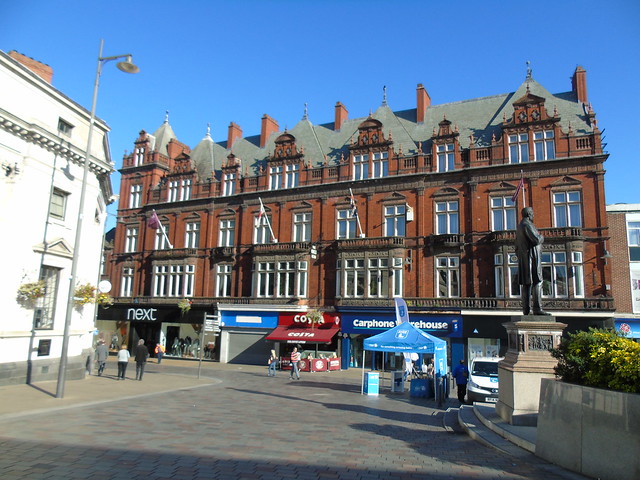
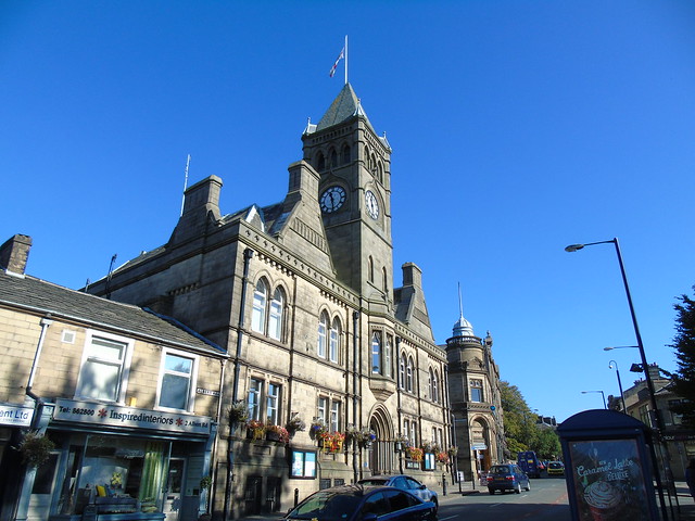
Northampton’s impressive Guildhall is one of the centre pieces of the town, designed by Edward William Godwin (1833 – 1886, English Architect from Bristol) when he was just 28! Construction took four years, from 1861 – 1864, and originally consisted of just the Eastern portion (right), including the main entrance, the symmetrical bays of 3 windows each on either side, and the Clock Tower.

A large extension was added by Matthew Holding in 1892, which became the Western (left) half of the building, adding another 6 bays of windows, and an extra entrance. What is perhaps most impressive is that despite the 30 year gap between the two halves being created, they merge seamlessly, using the exact same stone work and architectural style as Godwin.

A second, modern extension was added in 1992, to the left of the original Godwin design. Again it has been crafted to match with the existing stonework, with a modern touch to it. It does blend in rather well, creating a unique mix of old and new.

Most days the Guildhall is open to the public, and you can visit the breathtaking Great Hall at it’s centre. The Hall’s interior was created in two phases, with Colin Gill (1892 – 1940, English Artist from Kent) decorating the walls in 1925, and Henry Bird (1909 – 2000, English Artist from Northampton) adding in a series of Murals in 1949.

The Guildhall also contains a statue of Spencer Percival (1762 – 1812, MP For Northampton, Chancellor of the Exchequer, and Prime Minister of the United Kingdom).

Percival is notable as being the only British Prime Minister in history to be assassinated, by John Bellingham (1769 – 1812), in 1812.  This statue was created by Sir Francis Chantrey (1781 – 1841), and officially unveiled in 1817.

Leaving the Guildhall behind us, we followed “St Giles’ Square” road up towards the centre of town, to the rear of the finely sculpted All Saint’s Church. Before we explored the Church, we stopped to admire the Northampton War Memorial to the rear of the building, shown below.

The Memorial was designed by Sir Edwin Lutyens (1869 – 1944, English Architect from London who also created the Cenotaph in Westminster) after World War I, in tribute to the fallen soldiers of Northampton and the county as a whole. It was finally unveiled in 1926 after a number of logistical issues related to it’s intended position delayed construction.

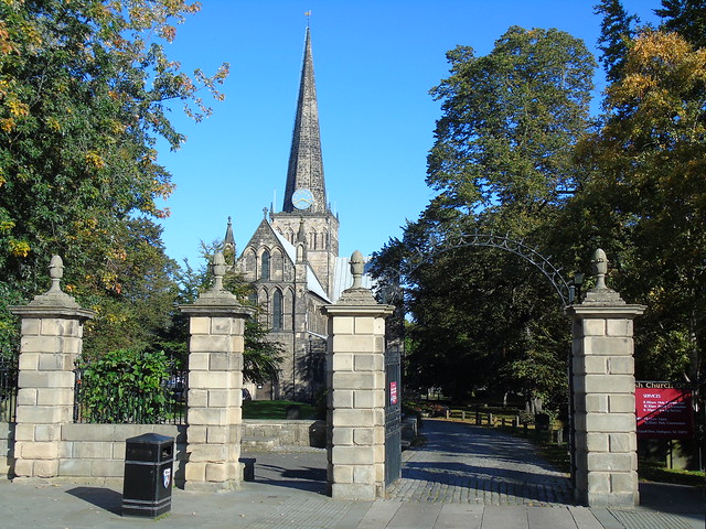
Moving round to admire the fine façade of All Saint’s, we were stunned at the colours of the stonework, which are quite similar to the Guildhall, and many other buildings in Northampton.

The Church is the successor to the previous “All Hallow’s” which previously stood on this site until 1675. It was on the 20th September of that year that tragedy struck, when a large blaze started in St Mary’s Street thanks to an open fire. It destroyed most of Northampton, including All Hallow’s. It was thanks to the generosity of King Charles II (1630 – 1685), who donated a large amount of timber towards rebuilding work, that the town quickly recovered.

One tenth of the money allocated by the King for rebuilding went towards the Church, with building work supervised by Henry Bell, an architect from King’s Lynn in Norfolk. It was built broadly in the same spot, and incorporated the stone tower from All Hallow’s which had survived the blaze. Building work was complete by 1680, whilst the large stone portico, incorporating a series of columns, was added in 1701. A statue of King Charles II stands above the portico, in recognition of his generosity after the fire.

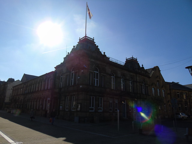
The Church is the centre piece of a large square in the centre of the town, with the Guildhall off the East End. Bounding the South side of the square is the local Tourist Information Office, housed in a combination of two buildings made up of the County Hall, and Sessions House. The two buildings were some of the first to be built after the Great Fire destroyed the rest of the town.

The County Hall is the main section to the right, created in the 17th Century as the “County House of Correction”. It replaced its predecessor, lost in the fire. A new town Gaol was built as an addition to the structure the following century. The Gaol already extant within County Hall became the Turnkeys House, home of the Keeper of the Prisons Keys.

By 1890 the buildings were no longer in use as a Gaol, with the Turnkeys House now the property of the County Council, whilst the rest was bought by the Salvation Army. Today it is used as a joint Tourist Information Office and the Northamptonshire County Offices, with Sessions House.

Sessions House (the portion to the left) is listed with a build date of 1678, another creation of Henry Bell. It was used as a Courthouse until 1991, and would have worked in tandem with the adjacent Gaol until it’s closure. Together the two buildings form a lovely pair, a fine example of the Georgian Architecture which has now come to typify the town as a whole.

From County Hall, we cut through to the Market Square, behind the large row of buildings on the North side of the Church. Prior to 1235, the local Market had been held in the Churchyard of All Hallow’s, until King Henry III ordered it be moved to the new Market Square.

The Square is notable as being one of the largest in England, as well as having one of the oldest running Markets.

At the North end of the square lies “Welsh House”, an old Elizabethan house from 1595. It was one of the few buildings to survive the Great Fire, when it was home to the Danvers family.

It has been altered various times across its history, so much so that in 1972 the Secretary of State ordered it to be rebuilt to match it’s original Elizabethan appearance.

An exploration of some of the surrounding streets, leading back towards the Guildhall yielded some interesting results.

The first was a large brick warehouse known as the “City Buildings”, designed by Alexander Ellis Anderson (1866 – 1935, Scottish Architect from Dundee). When it opened in 1900 it was in use by Malcolm Inglis & Company, established in 1796 and based up in Glasgow. The name of the company is still visible above the doorway, although the rest of the building has now been converted into flats.

Next up was Numbers 4-6 Gold street, which includes the stunning protruding set of 3 window bays. A late Victorian addition to Gold Street, it was added by S J  Newman in 1881, with a nice Gothic feel to it.

We had popped into the Tourist Information Office earlier, and picked up a great little leaflet with a suggested walking route around the time, and a few sites of interest. We decided to follow it, and headed West away from All Saints.

One of these was a short row of Elizabethan Town Houses, again a rare survivor of Northampton’s Great Fire. Constructed around 1662, they are known as “Cromwell House” and fit in rather well with some of the modern houses which surround them.

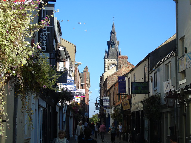
Further up Gold Street you will find the Church of St Peter, one of the oldest surviving structures in the town after only the Norman Holy Sepulchre Church from 1100.

St Peters was built roughly 50 years later, around 1160, although it would have appeared much smaller than it does today. It wasn’t until the 15th Century that the Crypt was built, followed in the 17th Century by the Tower at the West End

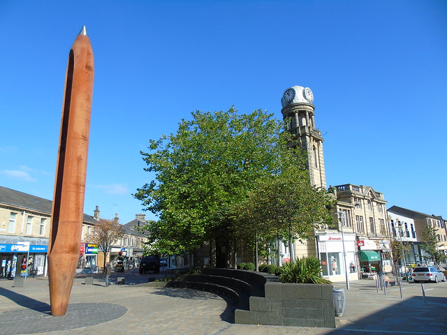
Northampton also has a number of interesting pieces of public artwork dotted around the town centre. The first one we found was on Abington Street, called “Discovery”.

Created by Lucy Glendinning, it pays tribute to Sir Francis Crick (1916 – 2004, Scientist from Northampton, Co-Discoverer of the DNA Molecule and the Double Helix). The shape of the sculpture itself echoes the Double Helix, with the figures (possibly representing life) twisting around each other.

At the other end of Abington Street lies another well known sculpture, called the “Cobblers Last”. It was crafted by Graham Ibbeson in 1986, and represents the towns historic Cobbler Industry.

So that was our trip to Northampton, a fantastic place to explore, with a variety of historic buildings, large open squares and many tales to tell.

Northampton is well placed, just a couple of miles out from the M1 Motorway, which heads South to the M25 around London, or North towards Yorkshire/East Midlands, and joins the M6 towards the North West/West Midlands.

The local railway station opened in 1859, and has direct services to London Euston, Birmingham New Street and Milton Keynes.  The town is largely bypassed by the West Coast Main Line, however limited services call here run by Virgin Trains, mainly Southbound. By road, Heathrow Airport is approximately 70 miles away, Birmingham 47, and Stansted 87.

We had had an interesting trip around Bedfordshire, Buckinghamshire and Northamptonshire but alas we had reached the end of our journey, so we headed home, another fascinating town under our belt…